Sunday, June 28, 2020

Using Google My Maps


I have experience with ArcMap so I decided to take a look at google my maps for its usability for new map-creating users. I have also used Google Earth in the past, which I have found very user friendly. I used that prior to ArcMap, as the latter requires a license.

I watched tutorial by Wicky Design on youtube - https://www.youtube.com/watch?v=lLJpcR5IK0.

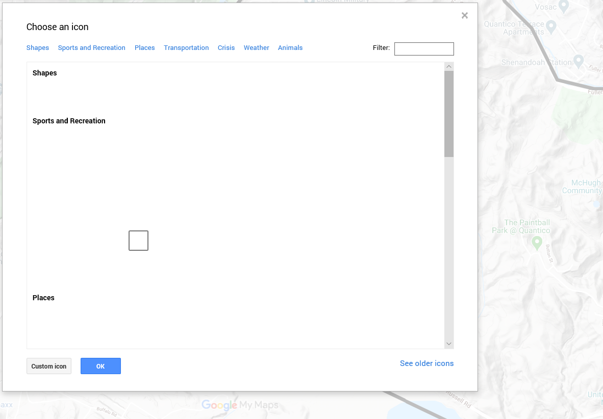
I had trouble with being able to see icons on the My Map viewer when creating the map:


As a result, I had to just hover over areas to see the description of the item come up. I never got this feature to work from my computer. I'm not sure if it's my issue, or Google's issue. I am using Microsoft Edge as my web browser, so it could be related to that.

One feature I would like to see is to the ability to move created points between layers. I started without a goal in mind, so I created all of my recreation points on one layer. In hindsight, it would have been nice to have hunting/fishing separate from picnic areas and wildlife viewing areas. Ideally, the wildlife viewing areas/picnic areas would be on it's own layer with hiking trails on Mainside. This feature isn't available in ArcMap either to my knowledge, nor is it available in the Avenza App (mentioned below).

Data Organization is important to make sure your markers are being placed under the correct layer. I use the Avenza mapping App for mapping certain things on base – mostly invasive species, but I also have a Morel mushroom layer and maybe other edible mushroom layers. I’ve accidently placed points in the wrong layer – this may not seem like a huge deal except for when I go to export a layer it may end up in the wrong group, OR I delete a layer I no longer need, but certain points were incorrectly tied to that layer, resulting in loss of data.

It is also important to set the default view of your map. If not, every time you open the map, google defaults to the view of the entire U.S. and you will have to search to find the area in which your map represents.

I do like ability to add photos to a point. For example, with each of my hunter “Parking Areas”, a photo could be taken of the exact location to inform hunters of where they should park. This could be helpful in situations where an area may have dense vegetation and the road isn’t paved. 

Overall, I think it's a very interesting tool and good for creating maps for the public. After creating the map, I sent it to a friend and they were able to see the map I created, the points I created as well as turn layers on/off. This would be great for recreational users as they could turn on/off a variety of layers that you had - hiking, hunting/fishing, picnic areas, etc. I think it would have high utility in certain job fields. I need to play around with it a little bit more as I attempted to export a PDF and it didn't work. This would be a great feature for planning hiking trips. However, if you don't have internet service, you probably won't be able to access google maps. This is the advantage to importing a georeferenced PDF into Avenza - from that app you do not need cell phone service to have the GPS track you. I will need to see what is going on with exporting a georeferenced PDF from google my maps to see if I can then import this into Avenza.

Thursday, June 25, 2020

Red Foxes

A few weeks ago on the base we got a phone call about a family of red foxes (Vulpes vulpes) that had taken residency close to one of the buildings on the mainside of base. The folks were fairly concerned about health and human safety, as well as the awful stench of rotting catfish carcasses, snake carcasses and fawn parts, so we went over and inspected the area, discussed the concern and gave them tips on what to do: make the foxes know they aren't welcome around the buildings. We told the staff to just make loud noises when you see them. We went back to the office and I did some research on fox kits and den usage and came up with the following info for them (and for a plan moving forward):

Red foxes are very well suited as urban adapters, tolerating human presence quite readily. Red foxes will mainly utilize dens during kit-rearing season and is harsh weather (think hard winters). They often repurpose groundhog (Marmota monax) burrows. In Virginia, it's illegal to trap and relocate foxes. When the kits are old enough (8 weeks), adult foxes will leave remnant food scraps around to help teach the kits to hunt. This was the reason for all the catfish heads laying around - in 90 degree weather, they smell pretty rough.

My plan of attack was to deter the foxes from maintaining their presence at the facility. I planned to put sticks and debris inside the den entrances. This would ideally make the foxes realize it's not worth it to stay put anymore, but wouldn't prevent them from being able to leave the den and starving to death. Ideally with repeated attempts, they'd run off for good. Additionally, I told the folks we'd set up game cameras on the den entrances and also remove the fish heads every time we came to check the cameras. I figured a solid approach to get the foxes to move along and a thorough effort to help the staff out is a win-win for everyone.

The result: success, sort of. Although I saw them around the facilities the first day I was there, after looking at the cameras, they seemed curious about the den entrances, but didn't really attempt to get back in them. So I learned that foxes often have multiple den locations, I assume in case one location is compromised such as in this case.

We're still working on pushing the foxes out of the other location - this time under another building. This one is just a sectional trailer on the base with plastic skirting around the bottom, so a foundation isn't present to deter the foxes. I will continue to monitor the foxes and see what we can do to have them move to less-occupied (forested) areas nearby.

Here are some photos of the foxes that we have on camera:

One of the fox kits
Practicing hunting?

On alert


"I've got your six"


Thursday, June 11, 2020

Why is biodiversity important for the Mainside of Quantico? How about Virginia? The United States? Globally?

As defined in a previous post, biodiversity describes all life within a given area. High biodiversity generally means having many different species present in a given area. Conversely low biodiversity means fewer different species present in a given area. High biodiversity is often a good thing, but this can be misleading if an area has high incidences of non-native, invasive species that out-compete native flora. Non-natives may not necessarily be bad, as some non-natives don't exclude other species. Additionally, just because an area has low biodiversity doesn't mean it is in a poor state - it just may not support greater biodiversity.

However, often when discussing highs and lows with respective to biodiversity, we are speaking about ecosystems being altered significantly enough to affect the biodiversity causing concern for the future status of the system as a whole.

One of my favorite ideas from Aldo Leopold discusses the idea of, and is titled "Thinking Like a Mountain". You can find a PDF version of his writing here. Leopold addresses the balance of the natural world and how humans can often cause disruption in that world, thinking they are making a positive change. He 'thinks like the mountain' and finds this may not be the case.

Locally, within the US, and globally over generations people have altered habitats through deforestation, species introductions, and resource exploitation. Each of these adversely affects biodiversity from a holistic perspective, as nature has balanced itself out over time, only to have humans disrupt the natural order.

What does the term 'Biodiversity' mean?

Biodiversity is a term used to describe the variance of all biotic and abiotic organisms within a given area (ditch, stream, watershed, woodland, ocean, globe, etc.). An area with high biodiversity has a wide range of organisms within it, as an area with low diversity has a small range of organisms within it.

I adapted my original definition form National Geographic to include ANY area. The original definition read “…. all biotic and abiotic organisms with an ecosystem.”.

Globally, approximately 1.2 million species have been identified and described. It is estimated that is a total of approximately 8.7 million species throughout the world (National Geographic).

Why I chose an in-depth study of the Mainside section of Marine Corps Base Quantico

Tentatively my study area is a section of Marine Corps Base Quantico, where I currently work. I originally wanted to do an area that wasn’t at my workplace, but I think this is a nice balance of an area of the base I’m unfamiliar with overall. Quantico is just under 60,000 acres. The section of base that I am planning to work with is a highly developed area, both with housing and workplace environments, and is approximately 5000 acres. This area of the base has numerous invasive species that we have documented (silk tree, Japanese knotweed, bamboo, phragmites), some of which we have removed. I plan to continue invasive species removal in the area. I do not have any experience in the following areas, but I’d be curious to learn more about them – stream restoration and pollinator habitat. There are multiple stream beds in this area and many of them are severely eroded – down to the bedrock. As for pollinators, there is an area on base that could be turned into a nature trail with pollinator gardens. The gardens would ideally include a walking path for local homeowners to walk along, but funding may become an issue there.
I’m really intrigued about doing this because it is an area that I can virtually walk almost every foot of. Throughout the course of this semester, so long as I’m consistent with it and purposeful with my intentions, I think I could really gain insight and knowledge of this section of base.

Starting a Non-Profit 501(c)3 Organization in Virginia

The Virginia State Corporation Commission webpage provides a wealth of information for starting a non-profit. They have a 'Businesses...